Features · Maps
Where it is.
Where it is going.
A place and an area as fields, a list’s records on a map beside the table, a map on a form whose courier glides along the road, and districts shaded by their orders. The page says what each map shows, by field name; your app chooses whose maps. This map is live. Move it.
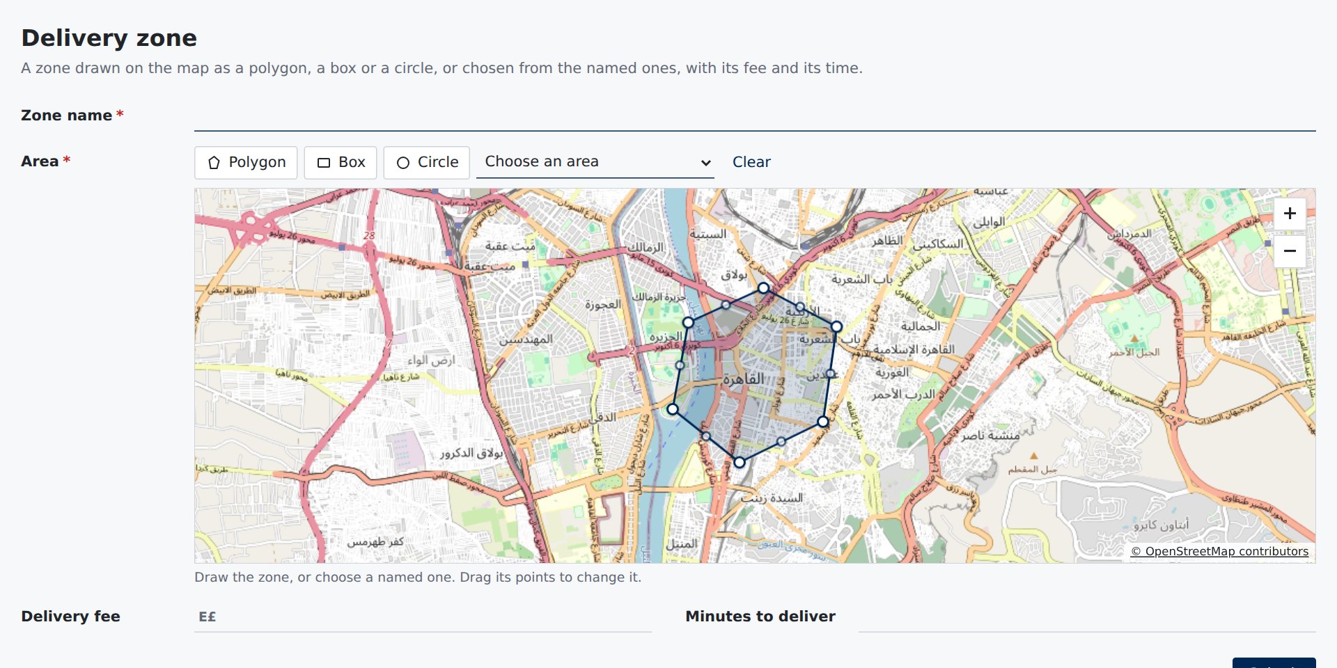
A place and an area
Fields that are places
A place set by searching an address, a press on the map, a dragged pin, “My location” or typed coordinates; an area drawn as a polygon, a box or a circle, or chosen from named ones. Kept as GeoJSON in a field. And an address on one line, suggested as it is typed, with no map at all.
- Addresses suggested as people type, over a map or in a text field that fills a place and the address’s parts
- Drawn by mouse, finger, pen or keyboard alone
- Named areas beside the drawing, for those who cannot draw
- Kept as GeoJSON your server can read
A list on a map
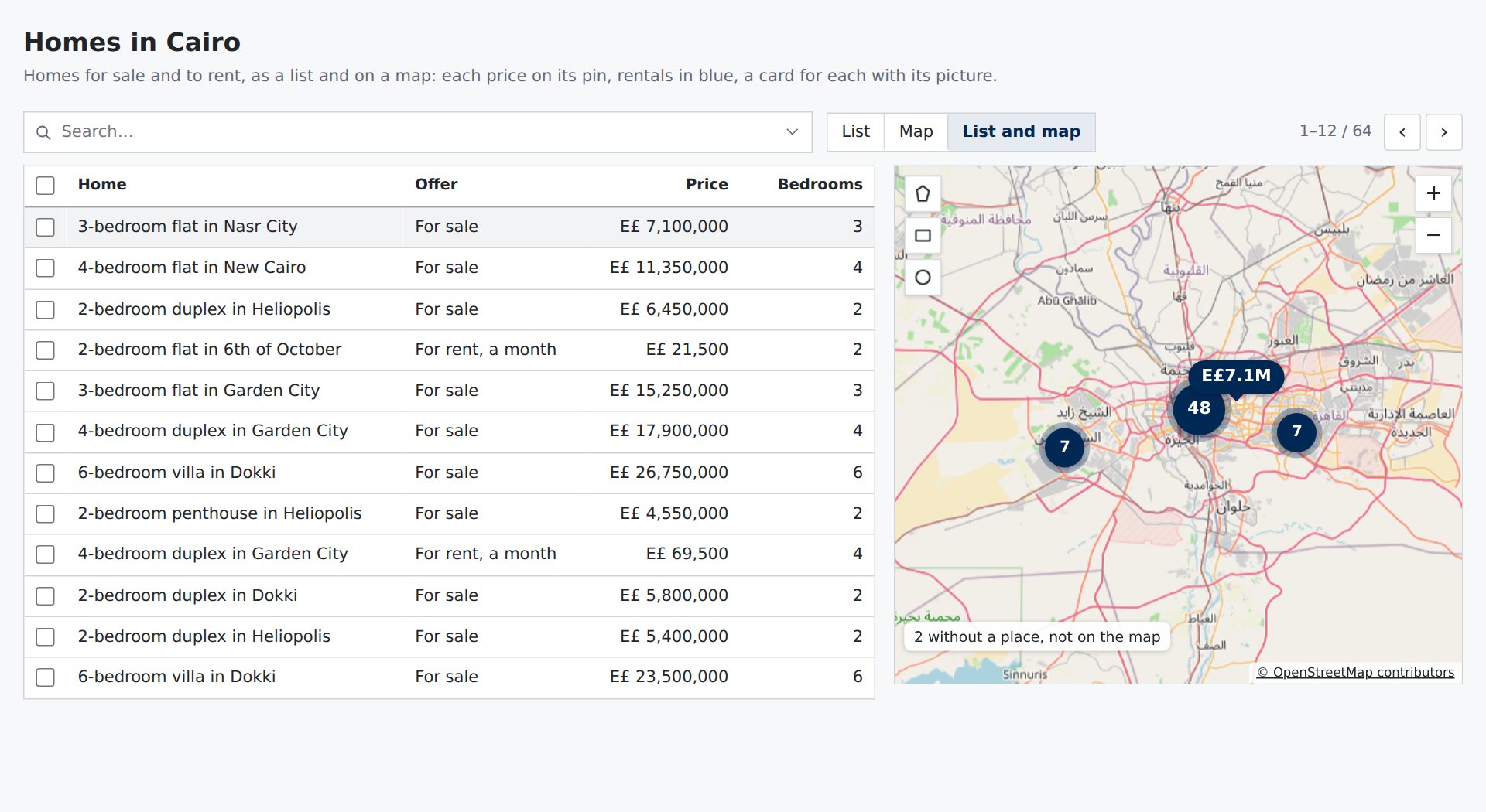
The records beside their map
A list’s records on a map: a price, a name, a car or a face on each pin, a card for each, crowded pins as one bubble; a pin lights its row and a row its pin; Search this area, or draw one. A price is short on its pin, its home currency unsaid and “/month” on a rent; a card’s lines can be bare, its title a link to the record’s page. Or the map alone, in a page of your own beside your own list.
- Pins drawn by the page: words, an icon turned the way it goes, a photo, a colour by condition
- The same search and the same records chosen as the table
- Search this area, saying how many are in view, or an area drawn to search in
- In your own page: filling its column, taking every gesture, its view kept in your address
Places that move
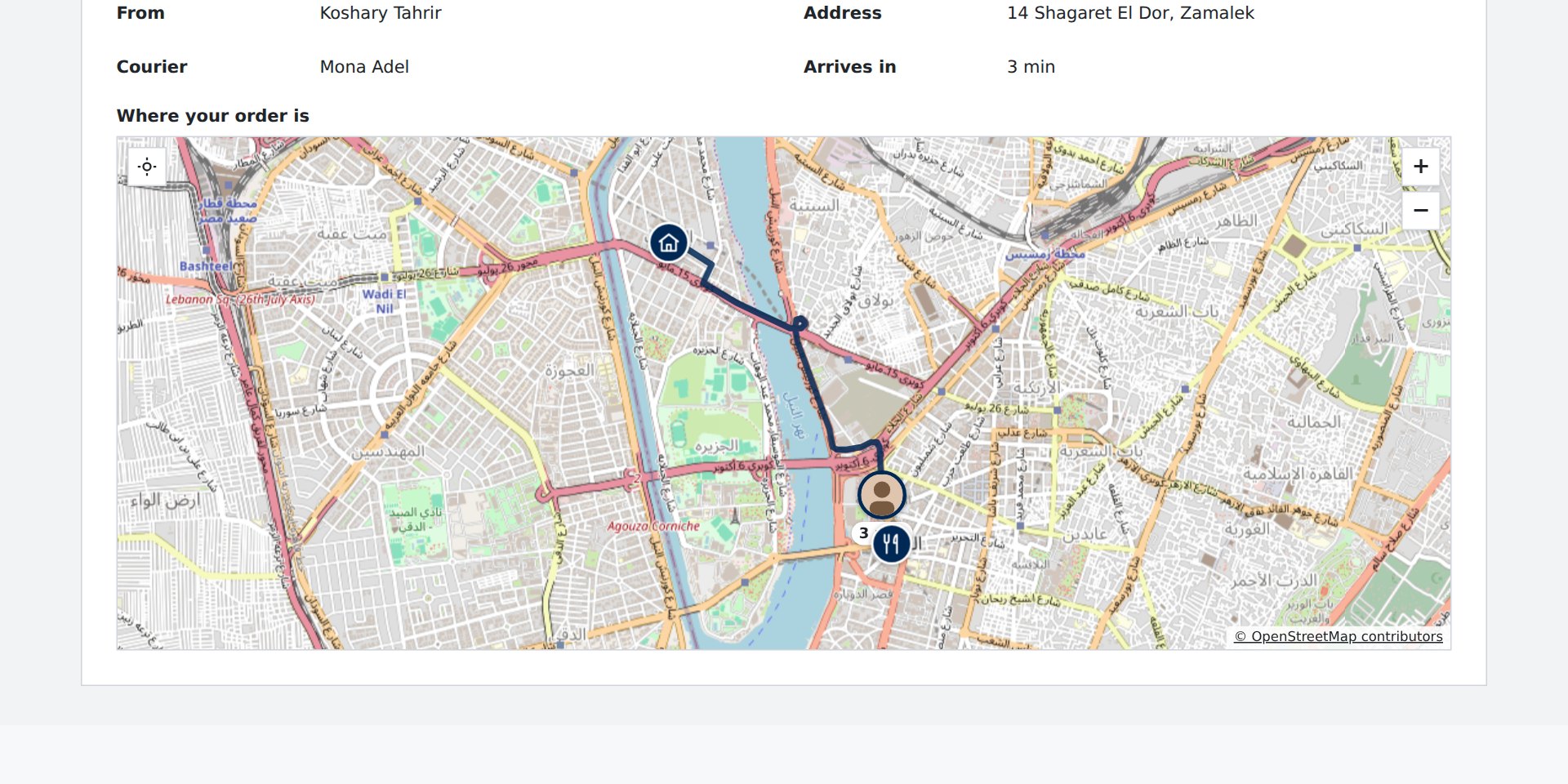
A courier on the way, the minutes counting down
A map on a form shows the record’s places as layers: a kitchen, a door, a courier who glides along the road as each new place comes in, the road behind them fading and the minutes left written into the record.
- Places that glide, grey when their news is old, followed until the map is moved
- Routes along the roads, by car, bike or on foot
- The time and distance left written into the record’s fields
- A place for each line: a round’s stops, numbered in their order
Areas by colour
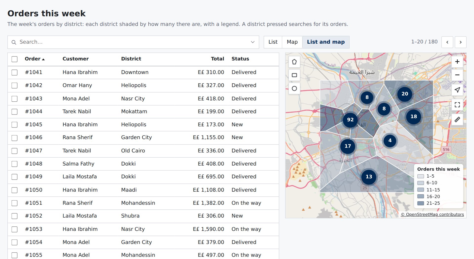
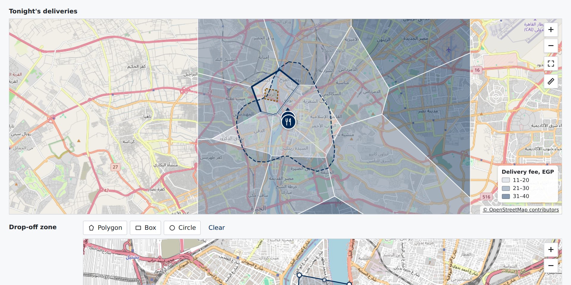
Districts shaded by their numbers
Districts, zones or municipalities shaded by how many records each has, or by a number of their own, with a legend. Point at one for its numbers; press one to search for its records, or to choose it into a field.
- Borders from your app: a file, a field or a function
- Shades from the page’s own accent, light and dark
- A press searches, or chooses the area into a field
- Every area by keyboard: one stop, the arrows from one to the next
Reach, fences and heat
Within fifteen minutes, and a step when they arrive
The area within some minutes’ drive of a place; a fence that runs the page’s own steps as a courier goes into an area; a heat map where pins are too many to read; and under the zoom, satellite images, full screen and a ruler.
- The area within some minutes, from Azure Maps, Mapbox or your app
- Fences that run steps as a place goes in or out
- A heat map from afar, each record’s pin back at the streets
- Satellite, full screen and measuring a way
Kept right
What maps need in an app
- Any providerAzure Maps, Google, Mapbox, your own map images, or OpenStreetMap’s for a demo. Keys stay on your server.
- Nothing until usedThe map engine, routes, areas and tools load the first time a page shows them.
- Every readerPins and areas by keyboard, named for screen readers, an area’s field always offering named areas.
- One pageThe page names what each map shows by field; the app gives the maps once.
Put your records on a map
Name the place field and what each pin shows, give the viewer your maps once, and every page can have one.